Table of Contents
Common Satellite Frequency Bands
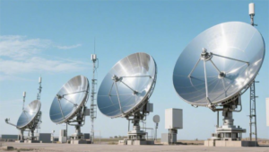
Satellite communications operate across a spectrum of radio frequencies, with the most commonly used bands being L-band (1-2 GHz), C-band (4-8 GHz), Ku-band (12-18 GHz), and Ka-band (26-40 GHz). These allocations are managed globally by the International Telecommunication Union (ITU), which coordinates spectrum to prevent interference among the over 5,000 active satellites orbiting Earth. The L-band, for example, is allocated precisely from 1.525 to 1.660 GHz for navigation systems like GPS, providing positional accuracy typically within 3 meters for civilian users.
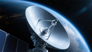
The C-band, spanning 3.7 to 4.2 GHz for downlink and 5.9 to 6.4 GHz for uplink, has been a workhorse for fixed satellite services since the 1970s, supporting television broadcasting with channel bandwidths of 36 MHz each. Ku-band downlinks range from 10.7 to 12.75 GHz, widely used for direct-to-home television, offering data rates up to 50 Mbps per transponder. Ka-band, operating at higher frequencies like 18.3-18.8 GHz for uplink and 19.7-20.2 GHz for downlink, enables high-throughput satellites delivering internet speeds exceeding 100 Mbps.
Choosing a band involves trade-offs; for instance, lower frequencies like L-band experience minimal rain fade (less than 1 dB attenuation in clear weather) but offer limited bandwidth, while Ka-band provides massive capacity (over 1 Gbps per beam) but can suffer over 20 dB signal loss during heavy rain.The L-band, covering 1 to 2 GHz, is renowned for its penetration capabilities through obstacles like foliage and building walls, making it ideal for mobile satellite services. For example, Inmarsat’s L-band network provides voice and data links for aviation and maritime users with terminal antennas as small as 30 cm in diameter, supporting data rates up to 650 kbps. Signal propagation loss at 1.5 GHz is relatively low, around 0.1 dB per kilometer in free space, allowing handheld devices to operate with transmit powers as low as 2 watts.
Transitioning to the C-band, which operates between 4 and 8 GHz, this frequency range has been the backbone of fixed satellite services for decades due to its resilience to rain fade, with attenuation rarely exceeding 2 dB even in moderate rainfall of 25 mm/hour. A typical C-band transponder offers 36 MHz of bandwidth, capable of carrying up to 12 digital TV channels simultaneously, and ground station antennas range from 1.8 to 3 meters in diameter for receive-only systems. The uplink power for C-band earth stations typically ranges from 50 to 200 watts, with installation costs for a VSAT terminal averaging $5,000 to $15,000.Moving higher, the Ku-band, spanning 12 to 18 GHz, is dominant for direct broadcast satellite (DBS) television, where downlink signals at 12.2-12.7 GHz are received by dish antennas as compact as 45 cm. However, rain attenuation can spike to 10 dB during heavy precipitation of 50 mm/hour, necessitating link margins of 3-5 dB for reliability.
L-band for Navigation and Phones
The L-band, operating between 1 and 2 GHz, is critically important for global navigation and mobile satellite services due to its excellent signal propagation characteristics. For instance, the Global Positioning System (GPS) uses the L1 frequency at precisely 1575.42 MHz, broadcast from a constellation of 31 active satellites orbiting at an altitude of 20,180 kilometers. This provides civilian users with a horizontal position accuracy of less than 5 meters for 95% of the time. In satellite communications, systems like Inmarsat utilize L-band frequencies between 1.525 and 1.660 GHz to offer voice and data services for maritime, aviation, and land-mobile users, supporting data speeds up to 650 kbps. The wavelength of approximately 20 centimeters allows signals to penetrate moderate obstacles like rain and foliage with low attenuation, typically under 3 dB even in adverse weather. The global market for L-band satellite services is valued at over $15 billion annually, supporting millions of devices worldwide.
In satellite navigation, the L-band is indispensable because its frequencies, around 1.5 GHz, experience relatively low atmospheric attenuation of about 0.1 dB per kilometer in free space. This enables signals from systems like GPS, GLONASS, and Galileo to reach ground receivers with minimal loss. A standard GPS receiver requires a signal strength as low as -160 dBW to function, which is achievable with small, low-power antennas often less than 10 cm² in size. The L1 C/A code used by civilian GPS has a chipping rate of 1.023 MHz, providing a theoretical ranging accuracy of about 3 meters. Modern multi-constellation receivers that combine signals from 30+ GPS satellites and 24+ GLONASS satellites can improve accuracy to under 2 meters 90% of the time. The time for a receiver to acquire a signal, known as Time to First Fix (TTFF), is typically 30 seconds from a cold start but can be reduced to under 10 seconds with assisted GPS using cellular networks. The power consumption for a handheld GPS device is low, around 50-100 milliwatts during active use, allowing for battery life exceeding 10 hours.
| Application | Specific Frequency | Typical Data Rate | Receiver Antenna Size | Approximate Cost (Terminal/Service) |
|---|---|---|---|---|
| GPS Navigation | 1575.42 MHz (L1) | 50 bps (navigation data) | <10 cm² patch | $100 device / Free service |
| Satellite Phone (e.g., Inmarsat) | 1.525-1.660 GHz | Up to 492 kbps | 30-60 cm diameter | 1,500 terminal / 100 monthly plan |
| IoT Satellite Links | 1.6 GHz range | 2-10 kbps | 10-20 cm antenna | 50 module / 5 monthly fee |
The design of L-band systems prioritizes link budget efficiency, with typical transmitter powers for user terminals between 0.5 watts and 2 watts for uplink. The gain of a standard 40 cm antenna is approximately 15 dBi, which helps compensate for path losses that can exceed 190 dB over the 35,000 km path to geostationary satellites.
For navigation, the signal-to-noise ratio (SNR) required is about 20 dB-Hz for reliable tracking, and modern receivers can achieve this with a noise figure under 2 dB. The bandwidth allocated for L-band navigation signals is narrow, often 20-30 MHz per frequency, but new signals like GPS L5 at 1176.45 MHz use a wider 20 MHz bandwidth to improve accuracy and robustness. In terms of capacity, a single L-band transponder on a satellite can support hundreds of simultaneous voice channels or thousands of low-data-rate IoT connections. The lifetime of L-band satellites is typically 12-15 years, and the cost to build and launch one ranges from 200 million to 500 million. The annual growth rate for L-band mobile subscriptions is around 5%, driven by demand in remote areas where terrestrial coverage is less than 10%. The power consumption for a satellite phone call is about 2-3 watts, allowing for talk times of up to 4 hours on a single battery charge.
C-band for Weather and TV
The C-band, operating between 4 and 8 GHz, has been a cornerstone of satellite services for over 50 years, primarily for fixed satellite services (FSS) like television distribution and weather radar. The downlink segment for satellite TV is typically 3.7-4.2 GHz, with the uplink at 5.9-6.4 GHz. A single C-band transponder with a standard bandwidth of 36 MHz can carry up to 12 standard-definition or 2-3 high-definition TV channels simultaneously. For weather monitoring, ground-based C-band radar systems operate around 5.6 GHz, providing a detection range of 200-250 kilometers for precipitation with a wavelength of about 5.3 centimeters, which is optimal for detecting rain droplets. The annual global market for C-band satellite services remains substantial, estimated at over $20 billion, despite increasing competition from higher frequency bands.
At 4 GHz, signal attenuation due to rainfall is minimal, typically only 1-2 dB even during moderate rain of 25 mm per hour. This reliability is critical for broadcasters, who require 99.99% annual availability for their feeds. A standard C-band satellite television downlink operates with an equivalent isotropically radiated power (EIRP) from the satellite ranging from 30 to 40 dBW. To receive this signal, a ground station uses a parabolic antenna with a diameter of 1.8 to 3.0 meters. The gain of a 2.4-meter antenna is approximately 35 dBi at 4 GHz. The associated low-noise block downconverter (LNB) mounted on the antenna typically has a noise figure of 15-20 Kelvin, which is crucial for maintaining a clear signal-to-noise ratio (SNR). The total link budget for a reliable C-band TV reception requires a carrier-to-noise ratio (C/N) of at least 10 dB under clear sky conditions. The initial investment for a professional C-band receive station can range from $2,000 to $10,000, depending on the antenna size and receiver quality, but the operational costs are relatively low. Each C-band satellite can host 24 to 36 transponders, generating an average annual revenue of $1.5 to $3 million per transponder. The typical lifespan of a C-band satellite is 15 years, and the cost to build and insure one exceeds $300 million.
| Application | Specific Frequency Range | Key Parameter / Data Rate | Typical Ground Antenna Size | Rain Attenuation (25 mm/h rain) |
|---|---|---|---|---|
| Satellite TV Distribution | 3.7 – 4.2 GHz (Downlink) | 36 MHz per transponder | 1.8 – 3.0 meters | ~1.5 dB |
| Weather Radar | 5.4 – 5.65 GHz | Peak power 250-1000 kW | 4.2 meter dish (common) | Negligible for short ranges |
| Telecom Backhaul | 5.9 – 6.4 GHz (Uplink) | Up to 155 Mbps (STM-1) | 3.7 – 5.0 meters | ~2.0 dB |
A typical C-band weather radar transmits pulses with a peak power of 250 kilowatts to 1 megawatt and can detect precipitation up to 250 km away with a spatial resolution of about 1 km². The radar antenna rotates at speeds between 3 and 12 rotations per minute, updating the precipitation map every 5-10 minutes. The velocity data measured by the Doppler effect has an accuracy of about 1 meter per second. The capital cost for a single C-band radar site is high, often between $1 million and $5 million, but it provides essential data for forecasting over a wide area of 200,000 km². In the past decade, the C-band spectrum between 3.4-3.8 GHz has been re-allocated for 5G mobile services in over 50 countries, causing potential interference and reducing the available bandwidth for satellite services in some regions by up to 20%.
The primary technical reason for C-band’s enduring role is its excellent balance between wavelength and precipitation resilience. A 4 GHz signal experiences approximately 80% less rain attenuation than an 18 GHz Ku-band signal under identical heavy rain conditions of 50 mm per hour. This physical property makes it indispensable for broadcast and data links where availability must exceed 99.5% annually.
The operational costs for maintaining a C-band link are significantly lower over a 10-year period compared to a Ku-band equivalent. While a Ku-band system might have a 40% lower initial hardware cost due to smaller antennas (1.2m vs 2.4m), the additional power required to overcome frequent rain fade events—which can occur for 50 hours per year in a temperate climate—increases the total cost of ownership. A C-band system requires an uplink power of 50 to 200 watts from the ground station, whereas a Ku-band system might need 100 to 400 watts to maintain the same link margin during rain.
Ku and Ka-band for Satellite TV
The Ku-band (12-18 GHz) and Ka-band (26-40 GHz) are the primary frequencies for modern direct-to-home (DTH) satellite television, serving over 250 million households globally. Ku-band downlinks operate between 10.7-12.75 GHz, with each transponder typically offering 33 MHz of bandwidth capable of carrying up to 10 standard-definition or 2-3 high-definition TV channels at data rates around 45 Mbps. Ka-band systems use higher frequencies, such as 18.3-20.2 GHz for downlink, enabling high-throughput satellites that can deliver over 150 Mbps per transponder, supporting 4K and 8K ultra-high-definition content. The dish antenna size for Ku-band DTH is compact, usually 45-60 cm in diameter, contributing to a terminal cost of $100-$300 for consumers.
- Small Antenna Size: Ku-band requires dishes as small as 45 cm, and Ka-band uses 60 cm dishes, compared to 1.8 m for C-band.
- High Data Capacity: A single Ka-band spot beam can support data rates over 500 Mbps, enabling 300+ HD channels.
- Susceptibility to Weather: Rain fade causes up to 20 dB signal loss in Ka-band, requiring 30% extra power reserve.
- Cost Efficiency: Consumer installation costs under $200 for Ku-band, with monthly fees from $20-$100.
The Ku-band’s downlink frequency range of 10.7 to 12.75 GHz is divided into sub-bands, with DBS services using 12.2-12.7 GHz in the Americas. A standard Ku-band transponder has a bandwidth of 36 MHz, but modern systems use channel bonding to achieve effective rates of 100 Mbps. The equivalent isotropically radiated power (EIRP) from a typical Ku-band satellite ranges from 48 to 54 dBW, allowing for a carrier-to-noise ratio (C/N) of 12 dB at the receiver. The low-noise block downconverter (LNB) on a 60 cm dish has a noise figure of 0.7 dB, and the overall system gain is approximately 50 dB. Rain attenuation is manageable; for 99% availability in a temperate region, a link margin of 4-6 dB is sufficient, as signal loss rarely exceeds 3 dB for more than 10 hours per year. The bit error rate (BER) for digital video broadcasting is maintained below 10⁻¹¹ after forward error correction. The initial hardware cost for a Ku-band DTH system is $150-$500, and monthly subscription plans range from $20 for basic packages to $120 for premium 4K content.
| Parameter | Ku-band (for DTH TV) | Ka-band (for High-Throughput TV) |
|---|---|---|
| Downlink Frequency Range | 10.7 – 12.75 GHz | 17.7 – 21.2 GHz |
| Typical Transponder Bandwidth | 36 MHz | 250 – 500 MHz |
| Max Data Rate per Transponder | 45 – 60 Mbps | 150 – 500 Mbps |
| Standard Dish Antenna Size | 45 – 60 cm diameter | 60 – 75 cm diameter |
| Rain Attenuation (50 mm/h rain) | 10 – 15 dB | 20 – 30 dB |
| Consumer Terminal Cost | $100 – $300 | $200 – $600 |
| Monthly Service Fee Range | $20 – $100 | $50 – $150 |
In contrast, Ka-band systems operate at higher frequencies, around 18-31 GHz, which provide greater bandwidth but increased susceptibility to atmospheric conditions. A Ka-band transponder often uses 500 MHz of bandwidth, supporting modulation schemes like 16-APSK to achieve data rates up to 400 Mbps. The satellite EIRP is higher, typically 55-60 dBW, to combat path loss that increases with frequency.
For a Ka-band downlink at 20 GHz, the free-space path loss over 35,786 km to a geostationary satellite is approximately 210 dB, compared to 205 dB for Ku-band at 12 GHz. To compensate, ground terminals use more powerful amplifiers, with output powers of 2-4 watts for the outdoor unit. The system noise temperature is higher, around 150 K, due to increased atmospheric noise. Rain fade is severe; in a tropical region with 100 mm/hour rainfall, attenuation can reach 40 dB, reducing availability to 98% without adaptive coding and modulation. The symbol rate for a Ka-band carrier is typically 30-50 MBaud, and the roll-off factor is 0.25. The latency for geostationary Ka-band TV is 500-600 milliseconds.
How Rain Affects Satellite Signals
The effect increases dramatically with frequency; for example, a 50 mm/hour rainfall rate causes less than 2 dB of signal loss at 4 GHz (C-band) but can cause over 20 dB of loss at 20 GHz (Ka-band). This attenuation can reduce the carrier-to-noise ratio (C/N) by 10 dB or more, leading to complete signal outage for an average of 10-50 hours per year in temperate regions and over 100 hours annually in tropical zones. The specific attenuation coefficient is approximately 0.01 dB/km for L-band, 0.1 dB/km for C-band, 0.5 dB/km for Ku-band, and 2.0 dB/km for Ka-band under light rain of 5 mm/hour. For a typical geostationary satellite link spanning 35,786 km, even minimal path attenuation compounds, requiring operators to incorporate link margins of 3-5 dB for Ku-band and 10-15 dB for Ka-band to maintain 99.9% annual availability. The global economic impact of rain-induced service degradation on satellite communications is estimated at over $500 million annually in lost revenue and mitigation costs.
- Frequency Dependency: Signal loss scales with frequency; Ka-band suffers 10x more attenuation than C-band.
- Rain Intensity Correlation: Attenuation increases by 3-5 dB for every 10 mm/hour rise in rainfall rate.
- Geographic Variability: Tropical regions experience 300% more annual outage time than arid climates.
- Mitigation Cost: Systems require 15-30% extra power reserve, increasing operational expenses by up to 20%.
The primary mechanism of rain attenuation is the absorption of radio wave energy by water molecules and scattering by raindrops, with the effect becoming severe when the wavelength approximates the size of the droplets. For a Ka-band signal at 30 GHz (wavelength of 10 mm), raindrops with a diameter of 2-5 mm cause significant scattering, leading to an attenuation rate of about 3 dB per kilometer during a heavy rainfall of 50 mm/hour.
The relationship between rainfall rate and signal degradation is not linear. A increase from 25 mm/h to 50 mm/h can double the attenuation from 10 dB to 20 dB for a Ka-band signal at 20 GHz. This exponential effect means that the worst 0.01% of rain events (about 50 minutes per year) can cause over 50% of the total annual signal degradation for high-frequency systems.
A typical UPC system can boost power from 5 watts to 20 watts within 10-30 seconds of detecting a 3 dB signal drop, adding $500-$1,000 to the terminal cost. The energy consumption during a 1-hour fade event might rise from 50 watt-hours to 200 watt-hours, increasing the annual electricity cost by $5-$10 per terminal. Adaptive coding and modulation (ACM) is another method, where the system switches from 16-APSK to QPSK modulation, reducing the data rate from 150 Mbps to 80 Mbps but improving the link margin by 5 dB.
Choosing a Band for Your Needs
The choice impacts initial costs, which range from under $100 for a basic L-band GPS receiver to over $10,000 for a professional C-band earth station. Performance varies significantly; Ka-band offers data rates exceeding 500 Mbps but suffers 20-30 dB rain attenuation, while C-band provides only 45 Mbps per transponder with under 2 dB rain loss. Geographic location is critical: tropical regions with 100+ hours of heavy rain annually may experience 15% more downtime with Ka-band compared to temperate zones. Operational expenses differ by 30-50% between bands over a 5-year period, with Ka-band requiring 20% higher power consumption during fade events.
- Budget Constraints: Terminal costs span $100-$10,000; Ka-band consumer systems cost $200-$600 vs. $1,500-$3,000 for L-band satellite phones.
- Data Rate Requirements: Needs from 2 kbps (IoT) to 500 Mbps (4K video); Ku-band delivers 45-60 Mbps, Ka-band 150-500 Mbps per transponder.
- Reliability Thresholds: Availability needs from 99.5% to 99.99%; C-band outage is <1 hour/year vs. 26 hours/year for Ka-band in Florida.
- Geographic Factors: Rain attenuation varies 300% by region; Ka-band loss is 20 dB in temperate zones but 40 dB in tropics.
- Antenna Size Limits: Dish diameters from 10 cm² (GPS) to 3 meters (C-band); Ku-band uses 45-60 cm dishes suitable for urban roofs.
A basic L-band GPS receiver costs $100-$300 with no service fees, while a maritime L-band terminal for satellite phones ranges from $1,500 to $3,000 plus $50-$100 monthly plans. For television, Ku-band DTH systems have hardware costs of $150-$500 and subscriptions at $20-$120 monthly, whereas C-band professional receive stations require $2,000-$10,000 upfront with transponder leases costing $1.5-$3 million annually. Ka-band consumer internet terminals cost $200-$600 with plans at $50-$150 per month. The installation time ranges from 2 hours for a self-install Ku-band dish to 8 hours for a calibrated C-band antenna. The payback period for an enterprise link is 18-24 months for Ku-band versus 30-36 months for Ka-band due to higher operational costs.
| Application Scenario | Recommended Band | Typical Budget Range | Expected Data Rate | Antenna Size | Annual Downtime |
|---|---|---|---|---|---|
| Global Navigation (e.g., GPS tracking) | L-band | $100-$500 device cost | 50 bps navigation data | <10 cm² patch | <0.1% (under 1 hour) |
| Residential TV in Rainy Climate | C-band | $2,000-$5,000 installation | 45 Mbps per transponder | 1.8-3.0 meter dish | 0.01% (under 1 hour) |
| Urban DTH TV | Ku-band | $150-$500 hardware + $20-$120/month | 45-60 Mbps | 45-60 cm dish | 0.1% (8.76 hours) |
| High-Speed Internet in Arid Area | Ka-band | $200-$600 terminal + $50-$150/month | 150-500 Mbps | 60-75 cm dish | 0.3% (26 hours) |
| Maritime Communications | L-band | $1,500-$3,000 terminal + $100/month | Up to 650 kbps | 30-60 cm antenna | 0.5% (44 hours) |
For low-data IoT sensors transmitting 2-10 kbps, L-band is sufficient with latency of 600-800 ms and power draw under 1 watt. For standard-definition video streaming at 3-5 Mbps, Ku-band provides reliable service with 99.9% availability in most regions at a cost of $0.50 per GB. High-definition TV at 10-20 Mbps requires Ku-band or Ka-band, with Ku-band costing $1.20 per GB and Ka-band $0.80 per GB but with higher outage risk.